
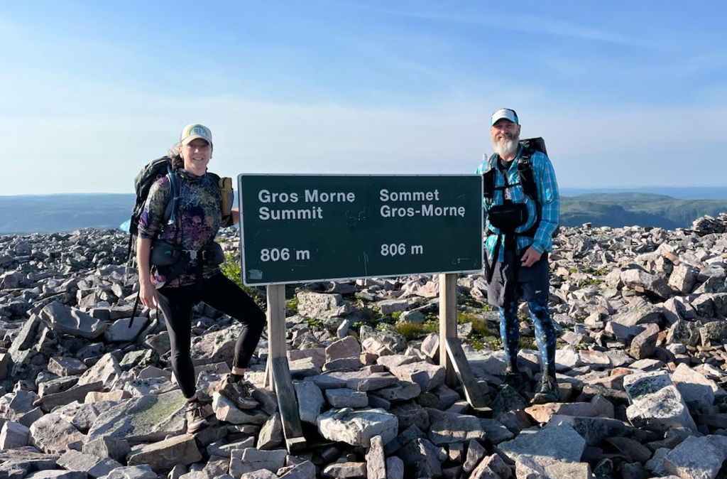
A few weeks back we travelled to our most easterly province, Newfoundland. Once there, we loaded up our packs and set out to hike The Long Range Traverse in Gros Morne National Park. Before being issued a backcountry trail pass, each hiker is required to attend an orientation session where a thorough safety briefing is delivered, the suggested route presented (it’s drawn on a map and you are required to draw it on yours), and any questions you might have about getting to the trailhead are answered. As the trail is entirely in the backcountry, is not marked, and is not regularly travelled by Parks Canada staff, there is an element of risk one must understand when endeavouring to complete it. Oh! And I should mention every hiking group must carry some sort of emergency beacon…so the rescue helicopter can find you…a non-negotiable requirement.
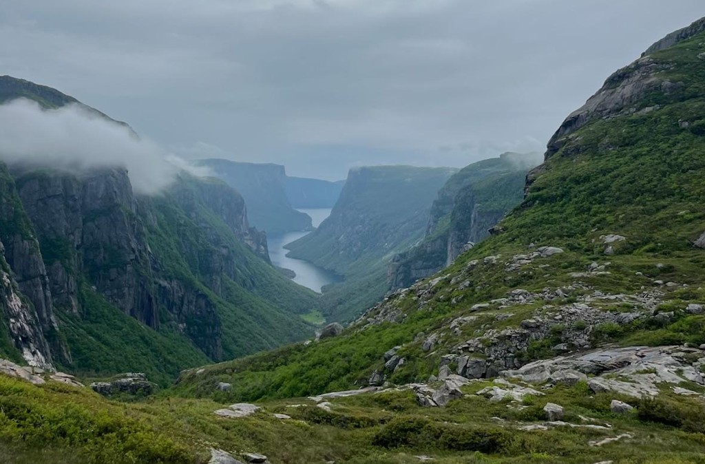
To reach the trailhead, each hiker must take the 16km boat ride through majestic fjords to the furthest point of Western Brook Pond, get dropped off on the 10’x10’ concrete dock…then watch the boat, filled with wide-eyed tourists…float away. No exits, no connecting roads, no way to go but into the forest to begin the journey into the backcountry. The first section takes hikers along riverbeds, through marshes and long grasses, traverses scrambled rockslides, then climbs vertical slabs up and out of the fjord…about 1200ft!…reaching the iconic and picturesque Western Brook Pond scenic lookout. You’re gonna have to trust me when I tell you, it’s even more incredible than all the pictures you’ve seen in travel brochures…although the pictures don’t show the swarms of black flies…just sayin’. #truestory
Although this trail is short in length, it is quite possibly the most technical trail we’ve ever hiked. As I mentioned, there is no marked trail, only animal tracks – moose and caribou – and footprints left by previous hikers…which we quickly learned were often not accurate and relying on them lead us astray over and over!! LOL The terrain was a mix of slab, spongy sphagnum, tundra, ice, snow, loose rock, steep rock climbs, lakes, mud, tall grass, and endless tuckamore.
We had our GPS map to assist us with route finding. We used the horizon to landmark off peaks, notches, lakes and plateaus and in the case of electronic failure, we also brought with us a paper map and compass. Our first day went well as we had decent visibility and made slow but sure progress to our first campsite. However, on the second day we woke to heavy rain and thick cloud cover, which meant very poor visibility. At best, we could see about 30-40 ft ahead of us…so no more using the horizon for landmarking. AND since the fog/cloud was so heavy, the GPS had trouble finding the satellites at times…ya…not great…
When we really started to struggle, when we couldn’t see ahead, when the GPS was struggling, our best decision would have been to take the wise advice given to us by the Parks Canada staff which was to stop, set up our camp and wait until the next day, or until the storm passed.
…but we didn’t #whenwillilearn
I don’t know the exact numbers, but I’m sure we added at least 5km to our hike that day. We stubbornly pushed on, knee-deep in mud and muck and soaked to the bone, we stumbled our way around lakes, scrambled over loose rock and hunkered down behind erratics just to get a break from the wind and rain…not our best showing.
We each had some pretty significant slips and trips (thankfully it was super muddy, so we just got extra dirty!), but one fall did break a trekking pole in half! And that wasn’t the worst of it. Finding ourselves far off the trail at times, we would try and find the most direct way back to it…often coming up against a lengthy stretch of tuckamore.
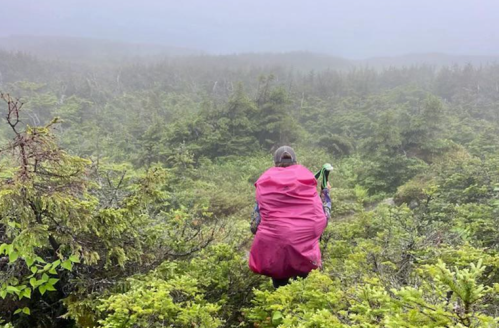
Tuckamore, we learned is gnarled evergreen trees, primarily spruce and fir, found along the coasts and barrens of Newfoundland and Labrador. These trees are shaped by the relentless coastal winds, growing low to the ground and often sideways, creating dense, almost impenetrable thickets…and tuckamore is prolific along this trail.
This stuff is no joke. The branches are so entangled, so rigid, and the hedge so deep, any attempt to get through results in deep scratches or torn clothing and equipment…not worth it. And you’d think that after the first failed attempt we’d have learned our lesson…nope. So often when we came up against tuckamore, and attempted to even just break through what looked like a “thin” section, we’d get hung up and had to fight our way back out…and then search for a way around the full length of the thicket.
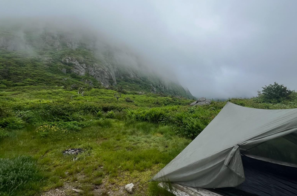
Fret not! We did eventually find our way to the next campsite, got out of our wet, muddy clothing, fought off legions of blackflies to make our supper and slept like logs…waking to clear blue skies and warm breezes the next morning…I will never understand the many moods of the mountains! LOL
I was really fascinated by the tuckamore, a truly remarkable phenomenon. I spent equal time thinking about my hike in Gros Morne; stubbornly pushing ahead, trying more than once to break through the impassible, knowing I would fail…when what I probably should have done was stop, rest, reset and begin again the next day.
Does any of that sound familiar? It sure does for me! #storyofmylife
It was such a good reminder of the importance of listening to the wisdom of others, especially those who have been through something similar. A reminder that rest does not equal weakness, but represents a certain type of strength, a strength that listens and knows when to pause and begin again another time.
If you can relate to my struggle as a stubborn, tuckamore-blazing, mud-laden, tired as dirt, wanderer…you are not alone! It’s not going to be easy, but my plan is to really work at this, and you can too. Let’s keep each other accountable…to flex muscles we haven’t used often enough…to remember to listen well to good council and accept when it’s time to rest.

Carrie
person with rheumatoid arthritis